THE UK has been baking in a record-breaking spell of sunshine including the hottest May day ever recorded on the Spring Bank Holiday.
With the , the Met Office is forecasting more sizzling weather before temperatures cool off.
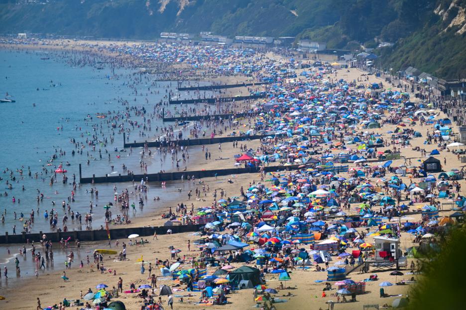 Brits flocked to the beach over the bank holiday as temperatures reached record highs for May Credit: Getty
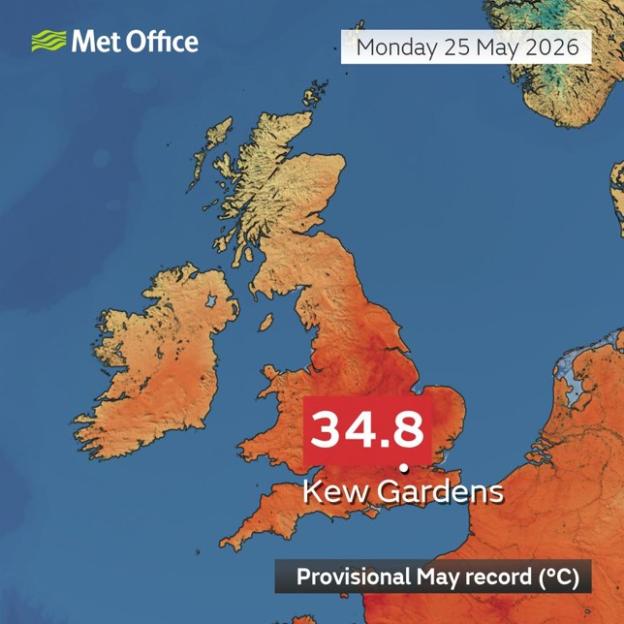 The Met Office said May 25 was the hottest May day on record for the UK, with 34.8C recorded at Kew Gardens
When does the UK heatwave end?
The current since the bank holiday weekend, when high pressure built over the UK and brought clear skies and rocketing temperatures.
The expects highs of 33C on Wednesday, 32C on Thursday, 30C on Friday and 29C on Saturday.
So the scorching spell is forecast to linger into the weekend, with cooler conditions predicted to return next week when the heatwave finally breaks.
The UK Health Security Agency has issued Amber and Yellow heat-health alerts across England and warned the extreme conditions could cause a “rise in deaths”.
Met Office Chief Operational Meteorologist Dan Suri said the country had “provisionally broken the spring and May temperature record” after Kew Gardens hit 34.8C on Monday, May 25.
The previous record of 32.8C was reached in 1922 and 1944.
What is the latest Met Office weather forecast?
The Met Office has warned that Tuesday could be another scorcher, with senior meteorologist Becky Mitchell predicting temperatures could hit 36C in areas of southern England and Wales.
More widely, the mercury is forecast to top 30C across eastern Wales, as well as eastern, southern and central England.
The Met Office said: “The start of the week will see the heatwave continue for much of England and Wales with temperatures well above average.
“Tuesday will be another very hot day, with a rapid rise in temperatures through the morning.
“A peak of 35C is again expected in London, the Home Counties and Cambridgeshire.
“More widely temperatures exceeding 30C will again be reached across eastern Wales, and eastern, southern and central England away from immediate coastal areas.“
The Met Office’s long range weather forecast from Saturday, May 30 to Monday, June 8 is as follows: “The south of the UK is expected to be mainly fine and dry for the start of this period, with temperatures above normal.
“It will be cloudier in the north with some rain at times, this heavy in places.
“Moving further into the period, conditions will likely become unsettled across the UK as a whole.
“Atlantic weather systems will move in from the west bringing showers or longer spells of rain at times.
“The rain will likely be heaviest in parts of the west and northwest. Temperatures will probably be near normal overall.”
What is a heatwave?
The Met Office defines a heatwave as an extended period of unusually hot weather.
In the UK, it is officially triggered when a location hits a specific temperature threshold for three days in a row.
These high temps often go hand-in-hand with high humidity, making the heat feel even more intense.
Due to the diverse climate across the UK, heatwave thresholds vary by county.
For example, this could mean up to 28C in London and southern , but only 25C in the North and .
Heatwaves usually strike in the summer when high-pressure systems settle over the country.
This happens when the jet stream moves north, bringing long spells of dry and settled weather.
The highest temperature ever recorded for the UK was on July 19, 2022, when the mercury hit 40.3C in Coningsby, .