DRAMATIC weather warning are continuing to hit a British holiday hotspot after authorities issued fresh alerts for towering waves and powerful winds.
The have now been expanded to cover all seven Canary Islands as an Atlantic storm system pushes in from the north.
 Fresh alerts for towering waves and powerful winds have been issuedCredit: Alamy
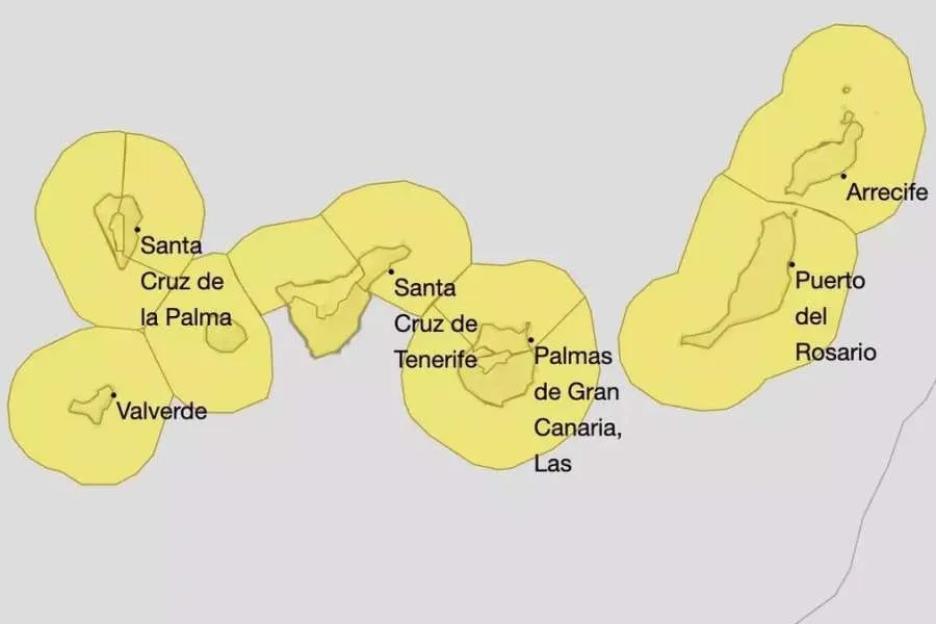 AEMET has activated yellow weather warnings across all of the Canary Islands this weekCredit: AEMET
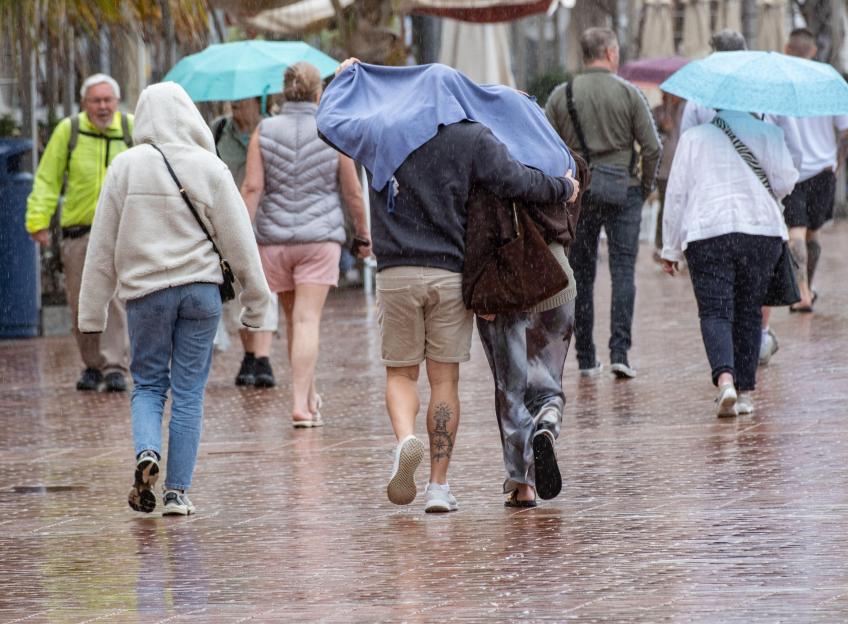
 Fresh alerts for towering waves and powerful winds have been issuedCredit: Reuters
The raging threatens to whip up huge seas and gusts of up to 45mph in the coming days.
Spain’s State Meteorological Agency AEMET has activated yellow weather warnings across the region.
Forecasters warn conditions could quickly worsen along exposed coastline.
The alerts come just as thousands of British families prepare to jet out to the popular holiday hotspot for Easter half-term breaks.
Tourist favourites Tenerife, Gran Canaria, Lanzarote and Fuerteventura are all expected to see dangerous sea conditions, with waves forecast to reach between four and five metres.
The rough seas are expected to begin hitting the islands from Wednesday, particularly along northern and exposed coastal areas.
At the same time, powerful winds will sweep across the archipelago from Thursday, with gusts of up to 45mph predicted in mountainous areas and along exposed coastlines.
Authorities are warning residents and visitors to take extra care near beaches, harbours and cliffside viewpoints as conditions deteriorate.
The storm will affect each island slightly differently, but no part of the archipelago will escape the warnings.
Tenerife and Gran Canaria are expected to see strong waves battering most coastlines on Wednesday, before gusty winds slam northern regions and mountain slopes on Thursday.
On Lanzarote and Fuerteventura, rough seas will arrive on Wednesday, followed by island-wide strong winds the next day.
Meanwhile the smaller islands – La Palma, La Gomera and El Hierro – could feel the impact even sooner, with rough seas beginning from Tuesday evening in some coastal areas before returning again later in the week.
The Government of the Canary Islands has also issued a “pre-alert” for coastal phenomena, which came into force at 9pm on April 7.
Officials said the decision was taken using data from AEMET and other monitoring systems, under the region’s emergency weather response plan.
Authorities warned of north-west swells reaching three to four metres across the islands, alongside strong winds between La Gomera and Tenerife.
The swell is expected to peak with long wave periods before gradually easing during Wednesday morning, although conditions may still change as the storm system develops.
The unsettled weather is being driven by a low-pressure system moving through the Atlantic just north of the islands, dragging unstable conditions across the region.
Meteorologists say alerts are typically issued up to 48 hours in advance, meaning the warnings could still be extended or upgraded if the storm intensifies.
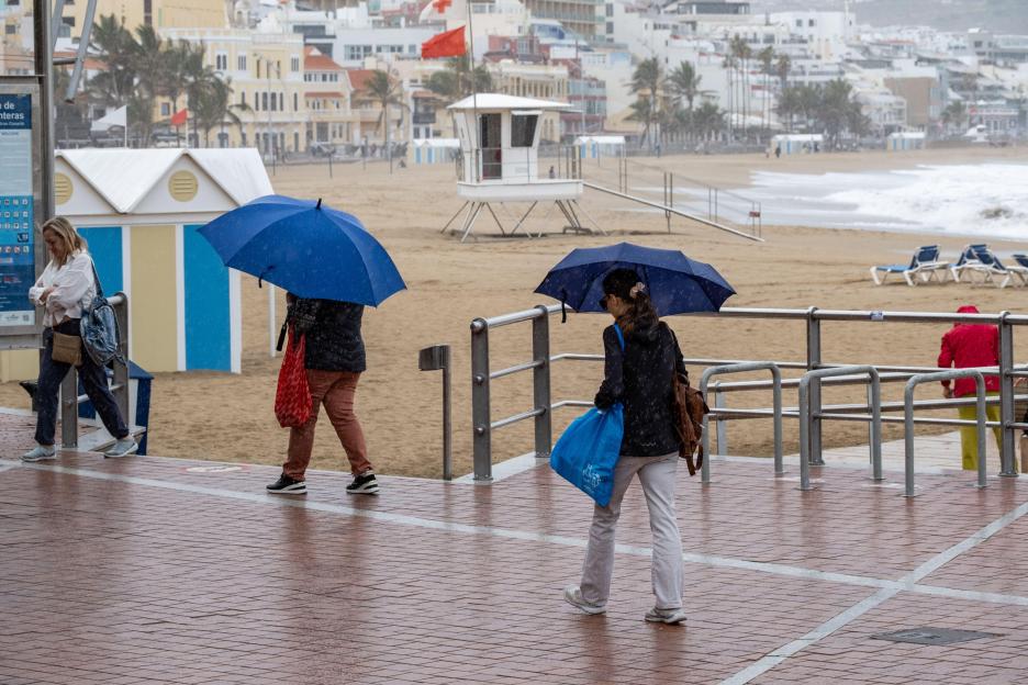 Authorities are warning residents and visitors to take extra care near beachesCredit: Alamy
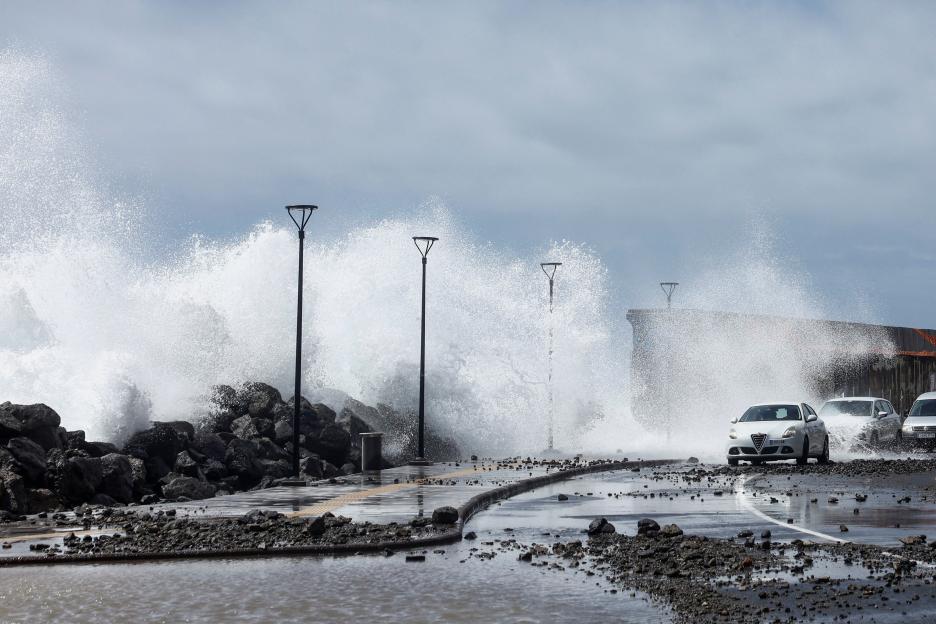
 The alerts come as Atlantic storm system pushes in from the northCredit: Ayuntamiento de Vega de San Mateo
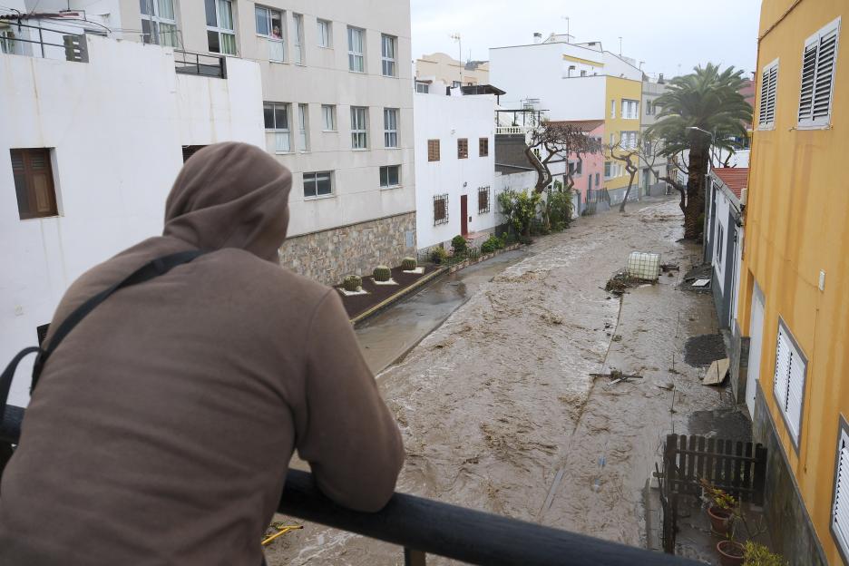 Last month Storm Therese unleashed devastating flooding and landslidesCredit: EPA
The system is also stirring up wild weather across mainland , where forecasters are warning of intense thunderstorms, hail and heavy rain in parts of the country.
In regions including Castilla y León, Castilla-La Mancha, Extremadura and Galicia, yellow warnings are in place for storms and heavy rainfall.
Powerful gusts could exceed 45mph in some mountainous areas, while Saharan dust drifting across the atmosphere could mix with rainfall to create “mud rain”, a phenomenon that coats cars, buildings and roads in dirty residue.
Temperatures in the region are also expected to drop sharply in western Spain as the unstable weather pattern takes hold.
The latest warnings will ring alarm bells for many tourists after recent storms already caused major disruption in the Canary Islands.
Last month Storm Therese unleashed devastating flooding and landslides, leaving more than 3,000 people stranded or displaced in Gran Canaria alone.
Entire communities were cut off after relentless rainfall washed away roads and caused ravines to burst their banks.
Evacuees while emergency crews battled the extreme conditions.
Popular tourist areas including San Bartolomé de Tirajana, Santa Lucía, Mogán and Telde were among the worst hit.
Mountain access routes became dangerously unstable, while coastal in Pozo Izquierdo were battered by fierce winds and sea spray.
In neighbouring Tenerife, winds reaching 73mph knocked out electricity and street lighting, leaving dozens without .
Authorities are urging visitors to stay alert to weather updates and take care along exposed coastlines, particularly as winds and waves intensify later this week.
Just last week another popular tourist destination was plunged into chaos when a engulfed the Greek island of Crete.
Storm Erminio also unleashed and across –
The popular tourist destination was cloaked in an eerie red-orange haze as thick African dust swept across the island, turning skies apocalyptic and forcing planes to divert.
 African dust storms bathe the island of Crete in an eerie red lightCredit: EPA
 Storm Erminio sweeps the land, causing havoc across all of Greece and its islands
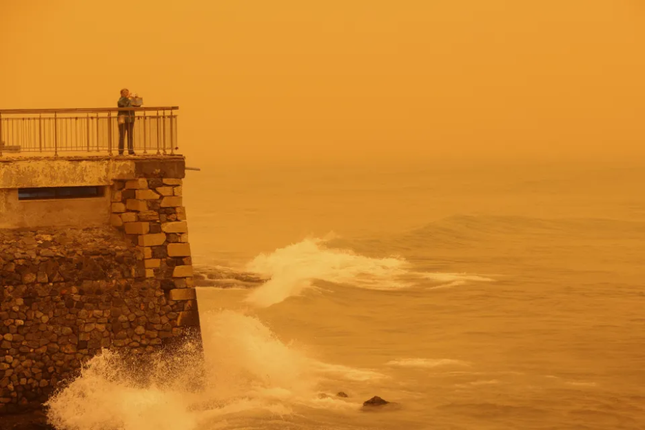 Saharan dust storms transform this usually idyllic island into a sickly yellow doomscape

Eze Chidiebere Paul
I'm dedicated to creating high-quality content that informs, inspires, and delights. If you have any questions or suggestions, don't hesitate to get in touch. Happy reading!