CANADA is battling raging wildfires, with hundreds of fierce infernos tearing through forests as residents flee.
The destruction has triggered national emergency measures as exhausted crews struggle to contain the fast-moving blazes.
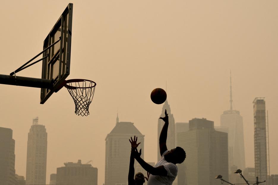 New York City was ranked the third most polluted city globally this week, as smoke from the Canada fires drifted south Credit: AFP
With millions of hectares of land already scorched and a thick, toxic smoke plume billowing across the continent, we look at the latest wildfire maps and how the crisis started.
What’s happening in Canada?
After a relatively quiet start, Canada‘s 2026 wildfire season has exploded.
Extreme summer heat and severe drought conditions across the country have turned its boreal forests into tinderboxes.
The boreal forest is a huge ring of trees spanning vast stretches of Canada that acts as one of the world’s largest carbon sinks, absorbing greenhouse gases and helping to regulate the global climate.
The vast majority of the fires were ignited by lightning strikes hitting bone-dry timber.
High winds and persistent hot have since fanned the flames, causing many of the blazes to merge and grow rapidly.
As of mid-July, the Canadian Interagency Forest Fire Centre reports almost 850 active wildfires burning across the country.
These fires have already scorched 1.9 million hectares of land this year, releasing large amounts of fine particulate matter into the atmosphere.
These microscopic particles can easily bypass your body’s natural filters, penetrating deep into your lungs and entering your bloodstream where they can cause respiratory and cardiovascular damage.
Which areas are worst affected?
While fires are burning across Canada, the province of Ontario is currently the worst-hit region.
More than 180 active blazes are burning, with the most severe activity concentrated in the remote northwestern part of the province.
Fierce winds have pushed massive smoke plumes southeast, blanketing major cities in both Canada and the US.
On Monday (July 15), Toronto was briefly ranked as the most polluted major city in the world due to the dense smog.
The toxic plume has since drifted across the border into the United States, prompting statewide Air Quality Health Advisories.
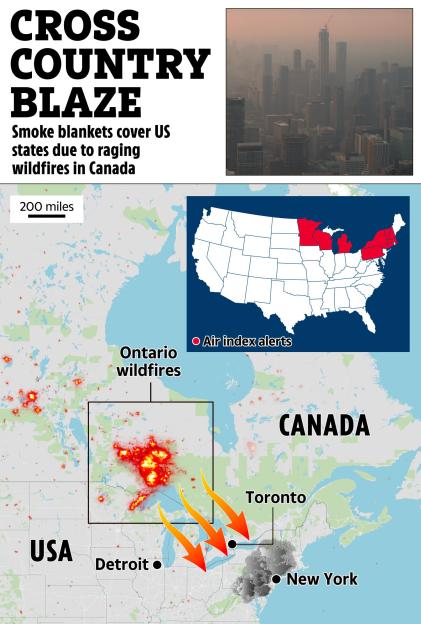 Fierce winds have pushed massive smoke plumes southeast, blanketing major cities in both Canada and the US
New York City was ranked the third most polluted city globally this week, with the air quality index (AQI) hitting “unhealthy” levels.
Upstate New York, including Buffalo, Rochester, and Syracuse, remains under strict warnings, while lower downstate regions, Long Island, and parts of New Jersey are blanketed in the thick haze.
How could the fires affect the World Cup final?
The poor air quality presents at on Sunday (July 19).
During a high-intensity 90-minute final, players will breathe in huge volumes of pollutants.
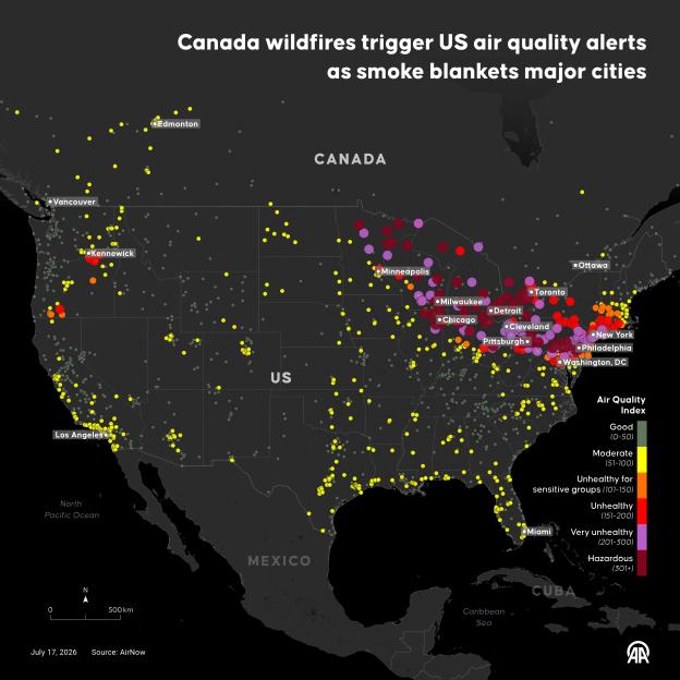 This map shows air quality alerts across the US and Canada; northeast America has been particularly affected by fires burning north of the border Credit: Getty
This can cause immediate chest tightness, coughing, and shortness of breath, reducing oxygen absorption and forcing players to fatigue much faster.
For Spain‘s high-pressing game and Messi’s quick-burst attacks, the smog could severely disrupt tactical plans.
But despite the thick haze, the final is .
The final’s New York New Jersey Stadium has strict health protocols, but matches are typically only postponed if the AQI reaches “hazardous” levels (above 200).
The , which should wash the soot from the air and clear the skies – though during the game.