BRITS are bracing for more rain and flooding after a major incident was declared in the wake of Storm Claudia — with a freezing cold snap now closing in.
The colder air is set to push southwards next week, with many areas feeling a sharp drop by Tuesday.
 A cold weather alert has been issued from 8am Monday, November 17, until 8am Friday, November 21Credit: SWNS
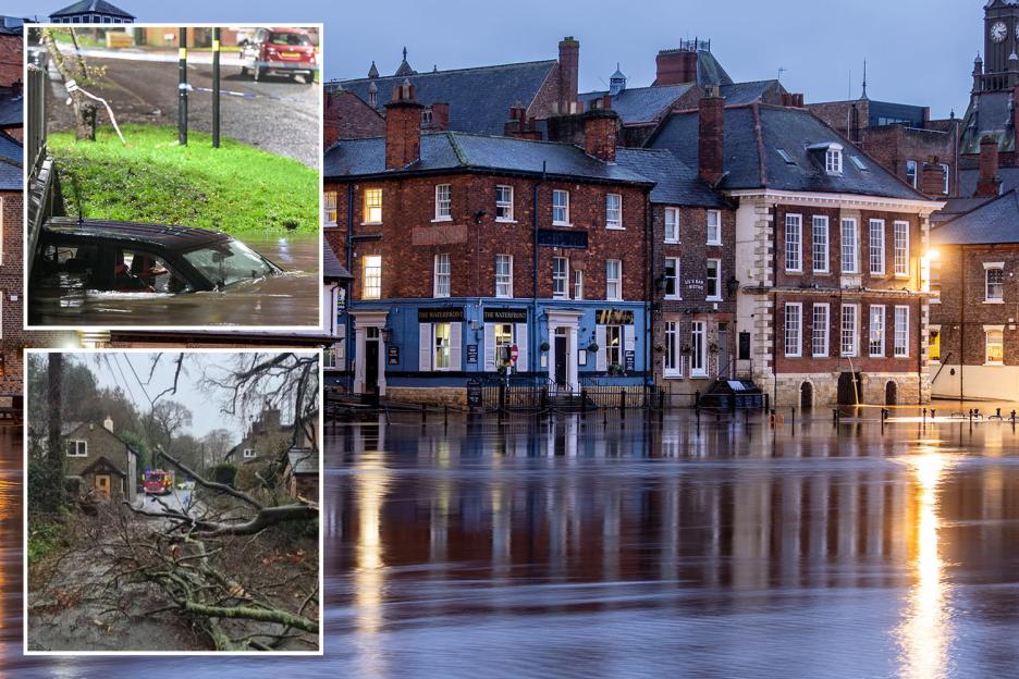
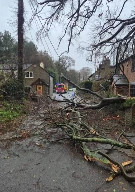 Three properties have been damaged and residents evacuated after a tree fell amidst stormy conditions in CheshireCredit: MEN Media
 Fire crews and police have spent Friday evening pulling people from submerged vehiclesCredit: X / @WestMidsFire
The Met Office has issued yellow weather warnings across large parts of the country, saying: “Storm Claudia will bring persistent rain from Friday evening into early Saturday and may lead to some flooding and disruption.”
Met Office meteorologist Honor Criswick said the worst of the storm had now cleared, but stressed that bitter weather was on the way.
A cold weather alert has been issued from 8am Monday, November 17, until 8am Friday, November 21, covering the , West Midlands, North East, North West, and and The Humber.
The Met Office added: “Sleet and snow showers possible, mainly focused towards north facing coasts and hills.”
Some northern regions could dip to -1C as icy winds sweep across the UK.
Heavy rain is expected to continue into the early hours, bringing 10–20mm widely and more than 40mm possible in higher ground such as the Mourne mountains.
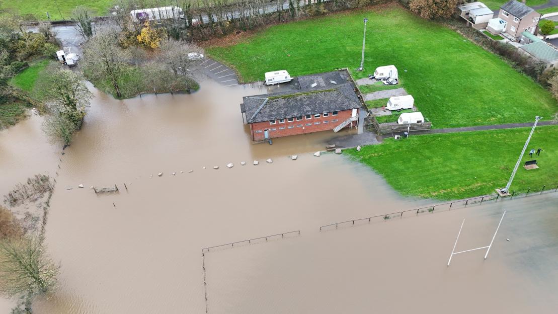
Roads have turned “like rivers” as emergency services scramble to deal with flooding, stranded drivers and worsening conditions.
Fire crews and police have spent Friday evening pulling people from submerged vehicles.
Strong easterly winds will add to the misery, and the recent spell of wet means the ground is already saturated.
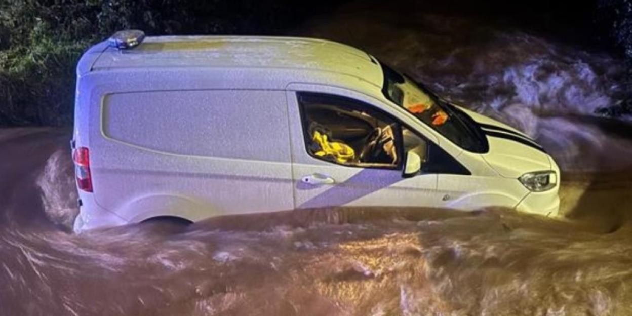
In Northfield, , a man had to climb onto his van roof for safety when the River Rea burst its banks at Hawkesley Mill Lane.
He was rescued by Fire Service at around 5pm after water surged around his vehicle.
Motorists have been rescued from submerged vehicles and firefighters have been stretched across the West Midlands.
Streets in the Black Country and wider region have also been hit, with some areas seeing water levels rise at worrying speed.
Photos from the scene show vehicles half-submerged, while residents reported drains “gushing like fountains.”
Elsewhere, were called to a head-on collision in Walsall just after 6pm yesterday.
The soaked roads and poor visibility made conditions treacherous, and drivers were warned to avoid unnecessary journeys.
Falling trees caused further chaos, crushing cars and blocking key routes.
Crews worked into the night to clear debris as the storm continued to push across the country.
Sally Davies, duty tactical manager at Natural Resources , said the rainfall from the -named storm would be: “extremely heavy in parts of South East Wales and Powys on Friday.”
She warned that already-swollen rivers could rise rapidly with very little notice.
 Flooding in Wandsworth, Birmingham last nightCredit: Alamy
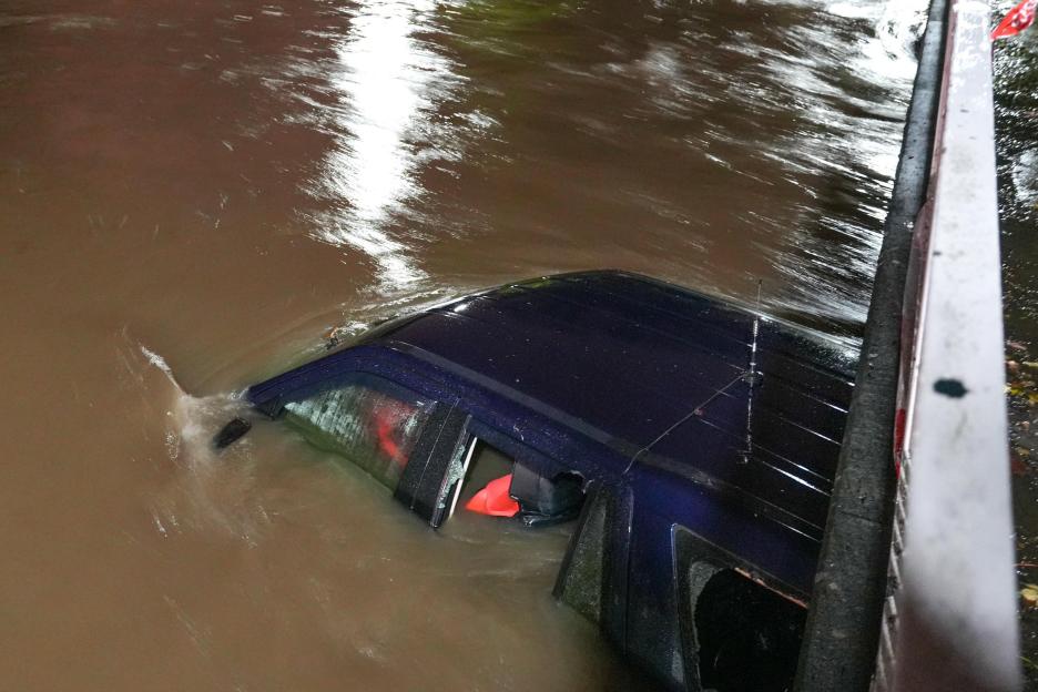
 A man had to be rescued from his van in Birmingham as it became trapped in floodwaterCredit: X / @CrimeLdn
In , where the storm’s rain has mixed with dropping temperatures, the first snowflakes of the season began falling early yesterday.
The northern regions saw a sudden flurry despite not being under any Met Office warnings, catching some by surprise.
Frosty mornings and slippery surfaces are expected, with gritters preparing to roll out in force.
Its long-range outlook for November 18 to 27 warns of “colder conditions, already affecting the far north of the UK” spreading across the country.
Snow is likely around Dumfries by Wednesday, and the west could see some hill snow too.
Forecasters say the remainder of November is “increasingly uncertain.”
However, the trend suggests a mix of rain, showers and further hill snow, especially in northern regions.
Despite the unsettled spell, temperatures are expected to drift back towards average later in the month.
Until then, Brits face another week of wet roads, swollen rivers and the first real bite of winter.
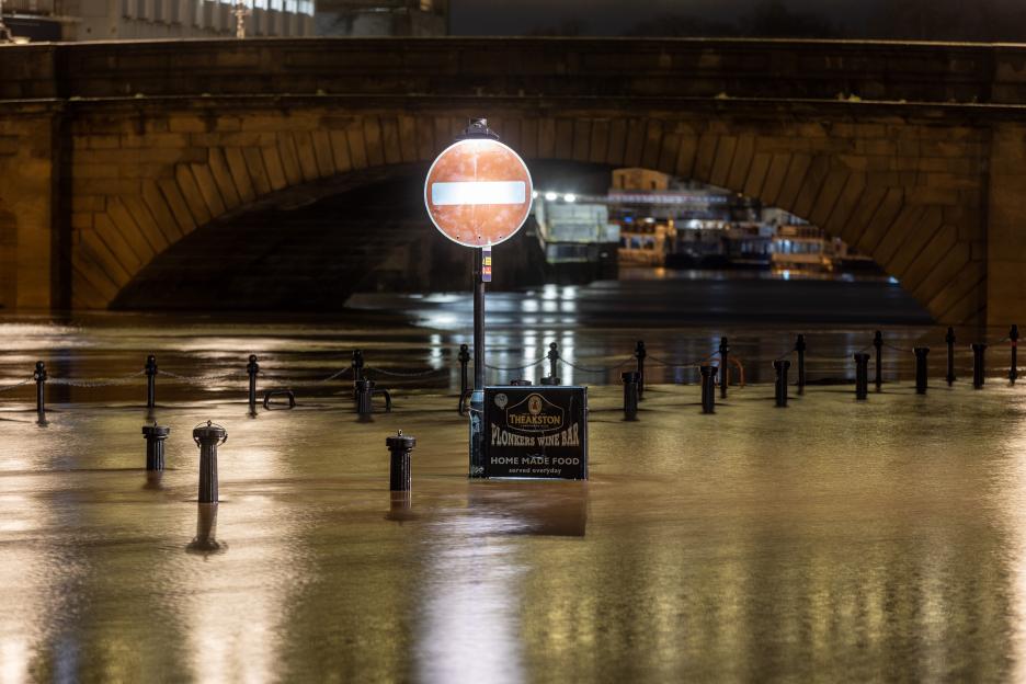 Flooding in York city centre this morning where the River Ouse has broken its banks rising to 3.07m & is expected to continue rising throughout the dayCredit: LNP
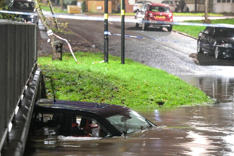 A 4×4 has been abandoned after the driver risked navigating a flooded ford in the Hall Green area of Birmingham on Friday nightCredit: Alamy
Eze Chidiebere Paul
I'm dedicated to creating high-quality content that informs, inspires, and delights. If you have any questions or suggestions, don't hesitate to get in touch. Happy reading!