BRITAIN is sizzling under another summer scorcher, with parks and beer gardens packed out as the nation basks in glorious sunshine.
But with the mercury high, many Brits want to know when we’ll get some relief from the sticky nights, or if the barbecue is here to stay.
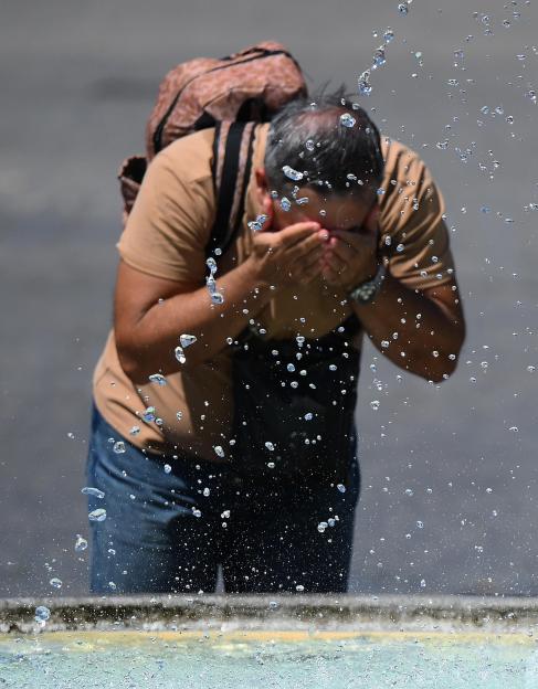 A person cools off from the heat in a public fountain Credit: EPA
When will the heatwave end?
If you’re waiting for a sudden, refreshing blast of cold air to clear the humidity, you might want to turn on the electric fan instead.
Forecasters say that the ending to this is going to be a slow, gradual process rather than an overnight reset.
According to the , high pressure is holding firm to the northeast of the UK, keeping things broadly settled and dry, especially for northern areas.
But low pressure lurking over the Bay of Biscay is threatening to spoil the party.
A potential tug-of-war between the two systems would mean the hot air could be stubborn to move, breaking down slowly and triggering a risk of thunderstorms drifting up from France into the south of the UK.
It means the heatwave won’t go out with a whimper, but potentially with a bang.
When will we start to see cooler weather?
Forecasters have pinpointed the middle of next week as the start of a transition phase.
From Wednesday, July 15 to Friday, July 24, the weather is set to undergo a bit of a shake-up.
While it will start warm or even “very warm” initially – with the southwest of England potentially turning downright hot – change is on the horizon.
While that period is likely to start with sunshine and high temperatures, particularly in the south and southwest, over the weekend of July 18 and 19, the weather will potentially turn more unsettled from the south, before clearer, more settled conditions arrive from the west.
The Met Office notes that even as things ease, further hot spells remain completely possible, especially across the south.
What is the Met Office’s long-range forecast?
Looking further ahead into July and the start of August , the weather picture becomes a proper mixed bag.
For the period from Saturday, July 25 to Saturday, August 8, the Met Office says the weather becomes “increasingly mixed.”
The high-pressure system that gave us this heatwave will lose its grip, making way for spells of low pressure.
This means more unsettled weather becoming likely as we head into August.
Holidaymakers should prepare for more thunderstorms and rainy spells, though it won’t be a total washout.
The best of any dry, sunny interludes will most probably be saved for the south and southeast.
Temperatures through early August are likely to remain warm or very warm, and the Met Office has confirmed that further spells of hot weather remain firmly on the cards.