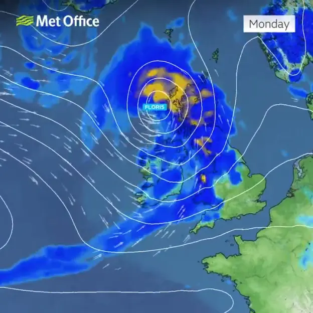
STORM Floris is expected to hit the UK in just days with forecasters issuing a ‘danger to life’ warning for many parts of the nation.
Britain will be battered by “unseasonably strong winds” of up to 85mph, says the Met Office.
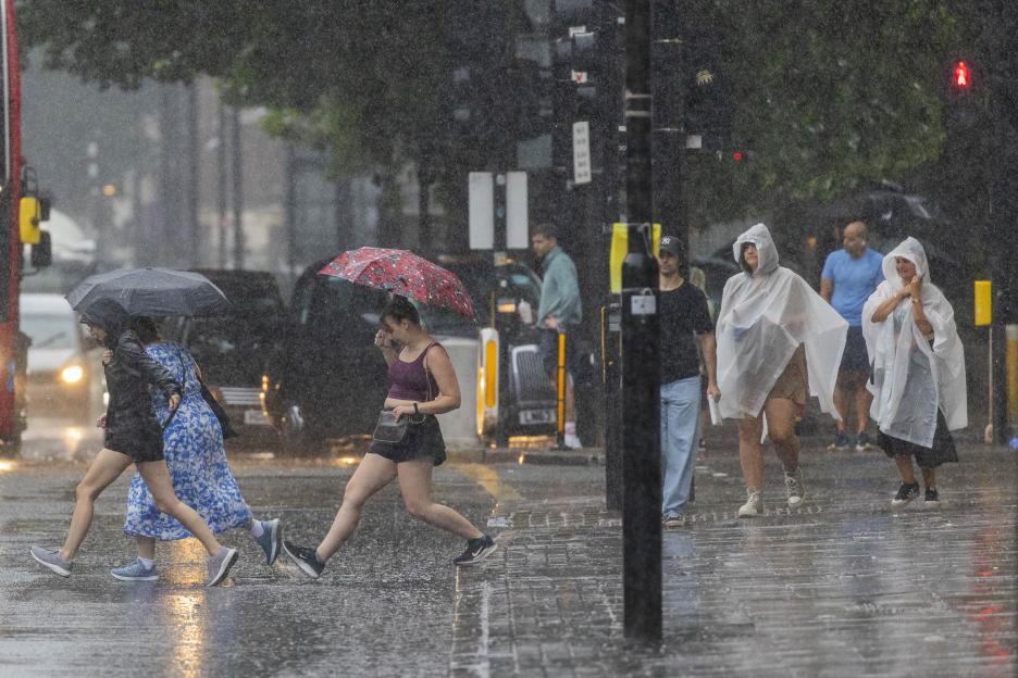
 The UK is preparing for strong winds and heavy rain
 The warning will be in place from Monday morning through to Tuesday
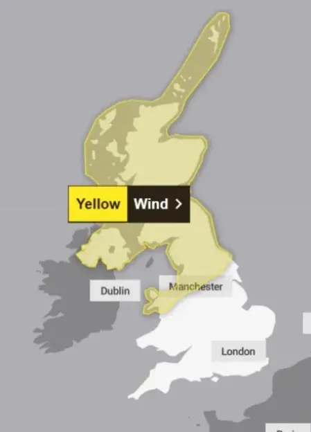
The yellow wind warnings will be in place from 6am on Monday morning.
As well as strong gusts, torrential rain is also expected to fall across huge sections of the country.
Scottish coastlines and high ground may even see wind gusts of up to 85mph.
A yellow wind warning has been issued for Scotland, Northern England , Northern Ireland , and north Wales on Monday.
The warning is expected to stay in force until 6am on Tuesday.
“Injuries and danger to life could occur from large waves and beach material being thrown onto sea fronts, coastal roads and properties,” said the weather agency.
Brits have also been warned of property damage such as “tiles blown from roofs” and risk of injury from “flying debris”.
“Power cuts may occur, with the potential to affect other services, such as mobile phone coverage,” the warning added.
Disruption to public transport services and delays on the roads are also predicted.
The strong winds will first begin to ease in the west on late Monday, but remain very strong until early Tuesday in the east.
Matthew Lehnert, a Met Office Chief Meteorologist, said: “Across the warning area, many inland areas are likely to see gusts of 40-50mph, with 60-70mph more likely at higher elevations and around exposed coasts in Scotland.
“There is a small chance that some locations here could even record gusts of 85mph.”
A spokesperson for the weather agency added on X: “Storm Floris has been named.
“Unseasonably strong winds, gales in the north, locally severe and accompanied by heavy rain. Disruption possible.”
RAC breakdown service’s Rod Dennis said: “This unseasonable bout of stormy weather will mean drivers in the north and west of the UK need to take extra care at the start of next week.
“It’s the height of the holiday season, so those towing trailers and caravans, as well as those with roof and tent boxes, must ensure their loads are properly secured.”
He advised motorists driver slower in poor conditions and leave later if the weather is too bad.
The expert also urged drivers to avoid exposed highland and coastal routes.
Storm Floris is the sixth named storm of this Storm Naming season.
It comes after Storm Éowyn which hit in late January and sparked several weather warnings.
Gusts of 100mph were recorded at Drumalbin in Scotland , the Met Office said.
 Most of the country will be affected by the brutal weather
 The weather is unseasonable for this time of year
 UK five day weather forecast
Today
A dry day for most on Friday with sunny spells. Showers developing across central and eastern England, some turning locally heavy in the afternoon with the odd rumble of thunder possible. Near average temperatures, feeling pleasant in the sunshine.
Tonight
Any afternoon showers fading away leaving a dry evening for most with some late sunshine. Dry overnight with clear periods and turning cool in the countryside with patchy fog possible.
Saturday
A dry day with plenty of sunshine and generally small amounts of cloud. Feeling warm in the sunshine with light winds, though a little breezy in some coastal areas.
Outlook for Sunday to Tuesday
Breezier on Sunday with rain clearing to sunnier skies later. Turning unsettled and unseasonably windy on Monday with some disruption possible. Drier but still rather windy on Tuesday.

Eze Chidiebere Paul
I'm dedicated to creating high-quality content that informs, inspires, and delights. If you have any questions or suggestions, don't hesitate to get in touch. Happy reading!